


|
|
|
|
|
|
| |
| 21-OCT-2006 | Dave Beedon |
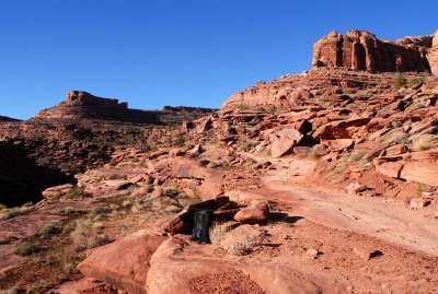
This is about 0.25 miles (0.4km) from the trailhead sign, looking up the rough road that serves as the "trail."
The trail ascends to the left of the distant mesa, then goes in back of it to an overlook of Jackson Hole.
.
All images are copyright 1966 - 2023 by Dave Beedon (davebeedon AT comcast DOT net).